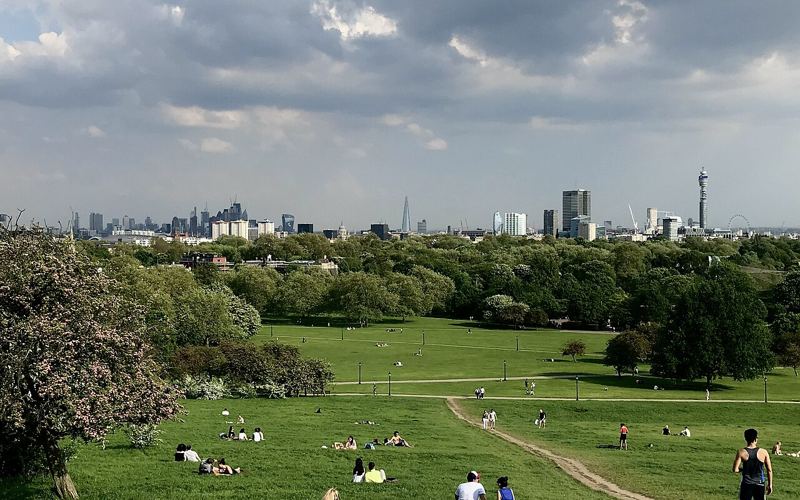
 Photo: LatteKnowledge, CC BY-SA 4.0
Regent's Park & Primrose Hill
IconicThe Outer Circle road around Regent's Park has a footpath for about 4.5 km. Add the Broad Walk and the rose gardens of Queen Mary's Gardens for variety, then cross the canal at the north edge and climb Primrose Hill. The summit stands 63 metres up, with a protected view over to St Paul's. Extend along the Regent's Canal towpath to Camden if you want more.
Route map & GPS tracks
Tap GPX to download a track for your watch or route app (Garmin, Strava, Komoot and others).
Refresh at a Coffee Shop or a Pub
The Little One
115a Regent's Park Road, Primrose Hill NW1 8URA tiny, friendly coffee shop on Primrose Hill's main street. It's mostly takeaway, so carry your cup up the hill.
The Princess of Wales
22 Chalcot Road, Primrose Hill NW1A quaint old corner pub named after Queen Alexandra. Londonist rates it the best pub in Primrose Hill, and its Sunday roast is popular.
Tube: Regent's Park, Baker Street or Great Portland Street. Chalk Farm for Primrose Hill.
Sunrise on Primrose Hill is worth the alarm.
Cafés and toilets inside Regent's Park.